NASA and IBM Launch Open-Source AI Models for Climate and Geospatial Insights
May 8, 2026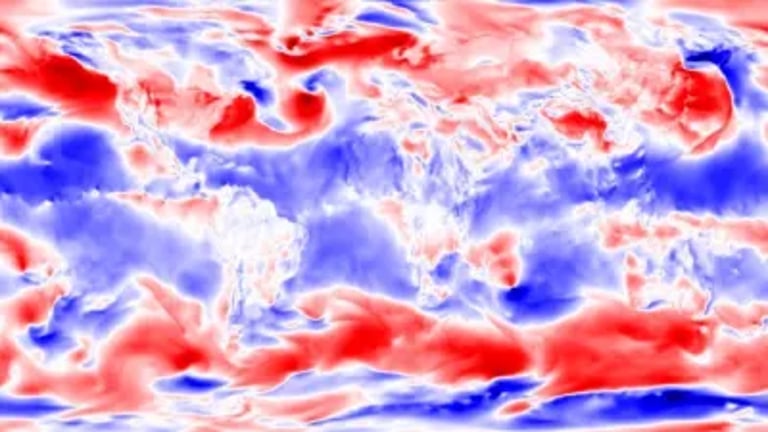
Beyond NASA, IBM is applying foundation-model concepts to critical infrastructure like the electrical grid to enhance resilience and integration of diverse energy sources.
NASA and IBM built open-source foundation models of the planet using Earth-imaging and weather data, releasing Prithvi for geospatial understanding and Prithvi for Weather and Climate with public versions for broad use.
Applications include supporting reforestation in Kenya, detecting urban heat islands in cities such as Baltimore and Johannesburg, and enabling carbon-credit assessments through surface-area classifications.
The geospatial model can identify land cover, detect floods and wildfires, track forest mass and carbon-capture potential, and quantify crop coverage, with capabilities demonstrated from minimal labeled examples.
The weather and climate model uses four decades of MERRA-2 data and enables high-resolution downscaling from roughly 100 miles to six or seven miles, improving hurricane path predictions and seasonal forecasts.
The model outputs have seen substantial uptake, with tens of thousands of downloads by May 2025, and the teams emphasize open development on Hugging Face to ensure transparency and broad accessibility.
The initiative originated from applying large language model principles to nonverbal Earth data, after developing Indus for NASA’s internal scientific literature by training on satellite image patches instead of text.
NASA and IBM plan to extend this foundation-model approach across five divisions of NASA’s Science Mission Directorate—including Sun, Moon, Mars, and future models for Astrophysics and Biological/Physical Sciences—alongside a cross-agency language-based model to facilitate user interaction with these AI tools.
Summary based on 1 source
Get a daily email with more AI stories
Source

Tech Briefs • May 8, 2026
Planet in a Program